

Summit Date
September 2, 2002, around 2:30 pm
Party
Ryan Cragun, Debi Cragun, Danny Stanley, Christy Stanley
Trip Report
Our wonderful friends, Danny & Christy Stanley, invited us to southwestern Virginia to spend Labor Day weekend with Danny’s parents, Sharon and Frank Stanley in Draper, VA. As part of the weekend that the Stanley’s had planned for us we were scheduled to go to Grayson Highlands State Park for a picnic. Danny, knowing of my highpointing interest, also noted that it might be possible to visit Mt. Rogers while in the State Park. Of course, being that close to the state highpoint, I subtly suggested that I would be excited to do that. It took a little convincing to get our spouses, Debi and Christy, to agree to go with us, but it was finally decided that we would hike Mt. Rogers on Labor Day. Frank and Sharon, incredible hosts that they are and showing intoxicatingly sweet southern hospitality, agreed to set up a picnic and take care of the grandchildren while we hiked the four hours that it would take to get to the top and back down.
So, with everything agreed upon, we headed to the State Park. We arrived at the picnic area around 11:30 pm and set some of the picnicking stuff up then Frank took us to the trailhead. We left Massie Gap at 12:15. I was the youngest of the group at 25, but the oldest only has 3 years on me. Being young, deluded, and full of energy, we made quick work of the first hill and were still going strong when we passed two women coming down the trail; one fully pregnant and the other pushing a stroller. We couldn’t help but ask if they had made it to the top, knowing that this would boost everyone’s confidence. Much to the wives’ chagrin they had only gone about 200 feet further up from where we met them before they had turned around.
However, we were not really worried about the difficulty because of the description in the guide book I was using. We crossed the first stile and followed the trail to the right so as to avoid the first summit. Eventually this trail led us toward a second summit, but was following a path around it when we decided it was likely just going to cut back and make its way up the hill anyway, so we hopped off the trail and made our way up some rocks to the top. When we got up there, we ran into some people, including a man who had been married for 50 years who had to have been in his seventies. He pointed out Mt. Rogers to us and Rhododendron Gap. We also realized that we weren’t at the gap and the trail that we had been on bypassed this summit altogether. We spent a few minutes talking then wound our way down the rocks (snapping a few pictures along the way) and caught the Appalachian Trail again, following it up to Rhododendron Gap this time. On top of the Gap we snapped a few more pictures, knowing this would likely be the best place for views, then dropped off the Gap headed toward Mt. Rogers.
We came upon a crossroads just below Rhododendron Gap. One branch was the horse route down to Massie Gap, continuing straight would lead us along the Crest Trail. There was no obvious turn off toward Mt. Rogers. We did see some of the wild ponies in the area so we went to look at them before continuing on the trail. We didn’t see a way toward Mt. Rogers so we continued straight.
Somehow we missed the turn off toward Mt. Rogers and were headed along the Crest Trail when we saw some people up on the summit that we knew was between us and Mt. Rogers. We knew we had to go that way, but we didn’t see the path that went up there. We did know that we had to cross several fences before we made it to the Thomas Knob Shelter, but we didn’t see the stile up ahead and decided just to work our way toward the summit that we knew was in the direction we were supposed to go. This shortcut turned mistake was the second that made our hike longer. Just after we found the trail we saw the stile that we knew we were supposed to use to cross the fence and realized we were finally on the right trail.
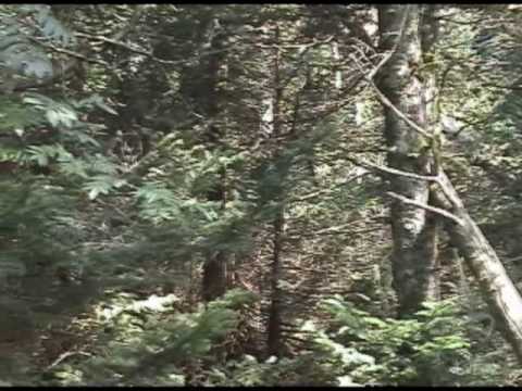
A few minutes later we came upon the Thomas Knob Shelter and stopped there to grab a quick drink. From the Shelter it was only another 20 minutes to the top. Though there is no notable view from the top, the last 10 minutes or so of hiking before you reach the summit are through very dense and humid forest. I found the forest to be very beautiful. There was no real undergrowth and the trees blocked most of the light. Moss covered everything below the canopy above. So you are aware, the highpoint really does not have a view and there is nothing to mark the highpoint except the USGS marker that is set in a large boulder in a very small clearing. The trail comes to a point (it isn’t a noticeably high point or peak) where it is difficult to determine whether it goes on and if so, where it branches. Stop there and look at the rocks to your left. Up on top of them you should be able to find the USGS marker. We arrived at the summit at 2:30.
We spent a few minutes on the summit snapping pictures and talking with some of the people that had summitted with us. There was another highpointer that arrived just after we did. I didn’t get his name, but he had done 16 highpoints in the previous 4 weeks.
We left the highpoint at 2:40. We still didn’t see where the trail went between Rhododendron Gap and the summit that lies between the Gap and Mt. Rogers. So, we dropped off the trail to the crossroads and took the horse trail down to where it reconnected with the Appalachian Trail. The horse trail smelled like horse dung (should have expected that) and was very muddy and rocky, but I think it saved us some time and definitely saved us some ascending and descending. The rest of the descent was fairly uneventful, though we all began noticing that our ankles were hurting. A word of advice, the trail can be very rocky at points. I would recommend some fairly sturdy hiking boots, ideally with ankle support.
Frank was supposed to meet us at the trailhead at 4:30, allowing us 4 hours for the entire trip. We dropped into Massie Gap at 4:10, making our trip time about 4 hours. Luckily, Frank decided he would come a little early in case we came out early and was already there when we arrived.
Final thoughts… Debi and I, the true city folks of the group, failed once again to put sunscreen on and cooked. Danny and Christy could dance naked in Hawaii for a week and wouldn’t burn. It was overcast most of the day, but we still fried. Take sunscreen because you will be hiking in the sun most of the time. Also, wear sturdy boots. There are trails all over the area headed toward Mt. Rogers. I don’t know that you can really go that wrong if you follow the signs, but just be aware that for every leg of the trip, there is at least one alternate route there (except for the last little leg from the Thomas Knob Shelter to the summit). The view from Rhododendron Gap wasn’t actually as good as the view from the summit just before it on the hike, but the view from there is very nice. The mountain ash (trees with lots of red berries) are all over up there. I had never seen them before, but they are pretty cool. The hike is nice, but long, plan on about 3-5 hours, depending upon your hiking speed and time spent dawdling. And, believe it or not, our wives only wanted us to carry them at the very end (actually they kicked butt)!
Panorama
![]()
