

Summit Date
July 18th, 2003 around 6:30 am
Party
Ryan Cragun
Trip Report
I had visited Mississippi’s highpoint on July 17th, 2003 and had planned on camping in Vicksburg, Mississippi that night. Though my small tent is waterproof, the campground where I had originally planned on staying was fairly waterlogged and from what I could see, the rain was still coming. I would have been sleeping on a water bed and it just didn’t seem worth paying $10 to be miserable in my tent. Instead, I decided to sleep in my car at a rest area I believed was just a few more miles down the road in Louisiana. Big mistake!
The rest area was just over the Mississippi. I pulled in and tried to get comfortable. The problem wasn’t so much that I couldn’t find a comfortable position in my very small car. It was the humidity; it was horrible. I thought that maybe I could let the air circulate by cracking the windows. When I opened the windows I let in a swarm of mosquitoes; that wasn’t going to work. I had to keep the windows up. The result was a combination of the humidity from my breath with the humidity levels outside and a build up of my body heat. It was like sleeping in a very uncomfortable sauna. I did get a couple of hours of sleep, but when the lightning that had been striking in the distance finally struck the actual rest area, knocking out all of the lights, I had had enough. Checking my route for the next day, I decided to drive the 130 miles or so to the highpoint and see if I couldn’t get away from some of the storm and humidity.
I made the drive and arrived at the parking area of the trailhead at around 3:30 am. I was tired again, so I tried to bed down and sleep a couple more hours until dawn. I did get a bit more sleep but was up at the time the eastern horizon was growing light. I wasn’t much more comfortable, but there wasn’t as much light (from the rest area lights and the lightning) and it wasn’t quite as humid.
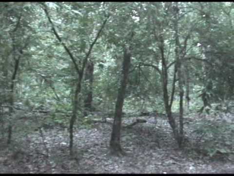
I got up at around 5:30 and spent about 30 minutes getting everything ready. I knew that I had about a mile hike to the highpoint. I did put on my headlamp but really didn’t need it. It had grown light enough that I didn’t have any problems. The trail to the highpoint seems fairly unused with quite a bit of overgrowth. Also, I was covered by spider webs by the time I actually made it to the summit. The hike time was about 20 minutes. I didn’t find a USGS marker on the summit, but there was a cairn of rocks, a registry, and a little tribute to Jakk Longacre, one of the founders of the highpointers club. I spent a few minutes snapping pictures, which didn’t turn out all that well in the dim light, but I did my best.
Packing up my camera I headed back down the trail. Twenty minutes later I was back at my car. I did see a pretty sunrise as I neared the trailhead and snapped some pictures of that. Otherwise, it was getting light, I had a long way to drive, and I was feeling pretty crappy from my horrible night’s sleep. I took off my hiking boots, switched them for sandals, and headed out, looking to make it to Mount Magazine in the early afternoon so I could make it to Oklahoma City that night.
Panorama
Directions

![]()
