Summit Date
July 19th 2003, around 3:15 pm
Party
Ryan Cragun
Trip Report
I drove in from Oklahoma City, arriving at the trailhead at around 1:00 pm mountain time. I hadn’t originally known whether or not I was going to do this hike on the 19th or the 20th, knowing that it was supposed to take between 3 and 5 hours. Because I was doing the hike alone I didn’t want to get caught out on the trail alone after dark. Because I made pretty good time from Oklahoma City, I thought I would be fine.
I spent about 30 minutes getting ready, filling up my Camelback, and throwing in a couple of extra bottles of water. I snapped some pictures of the trailhead then was about to head out on the trail when I noticed a bird’s nest built right on the information sign. I just had to get a picture of it. I also quickly looked around for a stick to carry with me in case I ran into any snakes on the trail. My guidebook warned that the trail was home to rattlesnakes and, hiking alone, I wasn’t particularly keen on meeting one unprepared. I did find a stick to carry with me and carried it with me all the way to the top and back, thinking it would offer at least a little more protection against a rattlesnake.
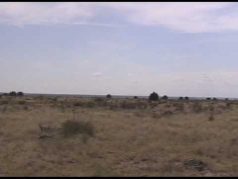
Once I had snapped some pictures of the bird’s nest and found my stick I headed out. The trail is very flat, with only gradual hills until you reach the base of the plateau just before climbing the switchbacks that take you to the top of the plateau. Also, though I am hesitant to admit it because people will likely begin cutting trails off of the already developed trails, the trail zigs and zags off of a straight course. If you were to cut a straight line to the base of the switchbacks you would probably cut off close to a mile of the trail. Anyway, I did follow the trail, both up and down, wondering who designed it. Also, there is something like a ranch or home of sorts almost near the base of the plateau. I’m sure that it is private property and they wouldn’t be very keen to people driving onto the property to cut off 2 miles of the hike, so you’ll just have to start from the trailhead.
The hike, until the base of the plateau is marked with green arrows and is very easy going. It took me about 40 minutes to get to the last of the green signs. The hike up the switchbacks is a little strenuous, but nothing major and is over in about 10 minutes. Once you get up on top, understanding why the Spanish word for table ‘mesa’ is used to describe these natural landscape features makes perfect sense, it is as flat as natural terrain gets. But keep in mind that once you are on top of the mesa you still have about 1 mile to go before you reach the highpoint. On top of the mesa there are also trail markers, but they seem newer and are yellow.
I was hyper alert on this hike because of the snake warning. Keeping my eyes open, I noticed some movement just as I reached the top of the mesa. Jumping back in fright, I wiped the sweat from my eyes so I could see clearly what I had to deal with. I first noticed a monstrous grasshopper. It must have been at least 2 inches long and an inch wide. It was the biggest grasshopper I’d ever seen. But only about 2 feet away was a horned lizard. It was about 4 inches long and 2 to 3 inches wide. I laughed at my fear, then snapped some pictures.
I continued on to the highpoint. Right next to the memorial on the highpoint is a cairn of rocks. I took off my pack as I neared the summit and was about to put it down next to the cairn to stretch my back a little but again found myself jumping back in fear as I watched a thin, tan colored snake hiding in the shade of the cairn disappear deeper into the cairn to where I was no longer able to see it. When my heart rate dropped back to normal, I gave the cairn wide berth and made my way to the memorial where I gingerly set my pack down.
I snapped a bunch of pictures and admired the unique memorial. The memorial has some interesting information on it, including mileages to distant cities and the surrounding states. I filmed my panorama and checked the impromptu registry. I didn’t sign it; I very seldom do. I spent about 15 minutes total on the summit, before loading back up and heading back down.
About 10 minutes from the highpoint I met a couple on their way up. I’m not positive of the names, but I think it was Dave Snyder and Deborah (not sure if they were married or dating or what, they didn’t say and I won’t assume it). They were really nice. I warned them about the snake in the cairn and we talked for about 15 minutes. Dave had summitted McKinley exactly two weeks previously and this was his highpoint number 34. I had to shake his hand. We had a good conversation then parted company.
I made my way back down and reached the trailhead about 3 hours and 15 minutes after I started. My feet were a little tired and I found that I had a few sore muscles the next day, but for the most part the hike doesn’t really push you. I did decide to stop in Kenton for something cold to drink. I had used up over two liters of water on the hike and all of my remaining water was hot. The only place open was ‘The Merc’, which apparently doubles as an impromptu hamburger stand. I got a couple of very great tasting drinks and headed north into Colorado.
Couple of suggestions: There are snakes, probably more visible if you hike to the trail early in the morning or when it is cooler out. It was very hot when I was hiking the trail, probably the hottest part of the day, so I didn’t see many. Also, take a lot of water, especially if you are going to hike the trail when it is as hot as it was when I hiked it. Using a continuous, medium pace you should be able to hike the trail in around 3 hours. The trail is very dusty. Also, it is very remote, which was nice for a change.
Panorama
Directions
Here’s a map from Boise City, OK:
View Larger Map

![]()
