

Summit Date
July 22, 2003, around 9:30 am
Party
Ryan Cragun, Tom Triplett, Mark Woolley
Trip Report
This is the fourth hike that Tom, Mark, and I did together; but only the third state highpoint. We decided on hiking Mt. Elbert because I was driving in from Ohio and this would prevent me from having to drive further than necessary. Also, the hikes that we chose to do together have to be rather strenuous hikes, as I had done a number of much less strenuous highpoints either alone or with people other than Tom and Mark. Combining these factors, Colorado seemed like a good choice.
Anyway, I spent the night in Leadville on the 21st then waited for Mark and Tom to arrive as they were driving directly to Leadville from Utah. I spent most of the day in the public library, which is very nice, has internet access, and a hardwood reading room. Also, it should be noted that though there are a number of Mexican-type food restaurants in Leadville, they aren’t particularly great. While in Leadville we tried two of them (La Cantina and The Grille) and were not particularly impressed. Tom and Mark arrived in Leadville at around 5:30 pm and, after eating a quick dinner and picking up a few more essential supplies, we made our way to a campground next to the Mt. Elbert trailhead (Mt. Elbert trail).
We spent the night at the trailhead and got up at 4:45 in order to be on the trail early so we could be headed down before noon. We completely broke camp and were on the trail by 5:30. At the trailhead we met a young couple from Canada who took a quick picture for us before we headed out. We started out about five minutes ahead of them but they quickly overtook us (more about them later).
The trail starts out going up for a ways, probably close to a mile of incline. Then you have a relatively short section that actually drops in altitude. After the altitude drop, which isn’t very long, the trail then heads up again and doesn’t really ever lose altitude after that. There are a few spots that are close to level, but for the most part it is almost a continuous 15-25% grade up the mountain.
It took us close to an hour and a half to get to the tree line. We had started out with light jackets and long sleeve shirts but quickly shed those due to the sweating caused by the uphill hiking. Once we cleared the tree line and were exposed to the chilling wind, we put back on our long sleeve shirts.
From the tree line, you can see the first false summit. It probably took us just over an hour to get to the first false summit, following the series of switchbacks up the ridge to finally wend our way around the summit to the north. It was just below the first false summit that we saw what looked like grouse. We actually probably wouldn’t even have seen them if they hadn’t moved because their feathers help them blend into the rocks and high-altitude vegetation so well, but they were the largest animal life we saw on the mountain. From the first false summit, you can see a second summit, which is also a false summit. It took us close to 45 minutes from the first false summit to the second. But once we reached the second summit we felt pretty good because the trail levels out quite a bit and you have just a 10-minute walk or so from the second false summit to the actual summit.
We arrived at the second false summit at about 9:15. Just below the second false summit we ran into the Canadian couple again, on their way down. They had already summitted, spent some time on the summit, and were headed back down. It was fascinating to watch how they climbed. They didn’t move very fast; instead, they maintained a slow, steady pace. And, they never stopped. As we climbed we would get to rather steep sections and would only be able to go 20 to 30 feet before stopping. They just kept plugging along at their mile-eating pace. They made great time.
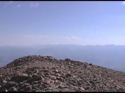
We arrived at the summit at 9:30 to find it relatively crowded. There must have been close to 20 other people sitting up there. We found a place to sit and munched on some of our snacks and food we brought with us. There were enough people that it was relatively easy to find people to take pictures for you. There was also quite a variety of people (foreign, local, old, young, etc.), though there were many more males than females. We spent close to 50 minutes on the summit: Mark wrote in his journal; Tom and Mark brushed their teeth; we took a number of pictures. Mark wanted to take a nap as we had done on Boundary Peak, but when we had already been there for close to an hour, I suggested that we get going in case any storms were to blow in early.
The descent was much more rapid than the ascent. We did stop several times to give our quads a breather and Mark’s knees weren’t very happy with him after about an hour of going down the trail. Nevertheless, we probably only stopped 4 or 5 times on the way down. Tom did get a few blisters on the way up and Ryan began to get some pretty serious blisters on his heels about half way down. Of course, being as high up on the mountain as we were, there wasn’t much we could do other than continue, which is what we did, much to the chagrin of our feet.
Anyway, we made it back to the tree line in about an hour and 15 minutes. Most of the time while we were above the tree line the wind was blowing strongly. We kept our long sleeve shirts on until the tree line where the wind dissipated and the temperature increased. From the tree line it was about another 45 minutes back to the trailhead. By the time we reached the trailhead, we were pretty tired and our feet hurt, but we were actually very surprised that we had climbed the mountain in close to 6 hours (actual climbing time, not including the 50 minutes on top). We aren’t in particularly good shape, well, Mark and I weren’t; Tom was. Nevertheless, we made pretty good time; at least, we thought we did.
Knowing that we were going to get off the mountain relatively early, we decided to drive back to Utah that day. We took a slightly different route to get back to I-70 (through Aspen instead of Leadville) and stopped in Aspen for lunch. From there it was close to 7 more hours to get to the Ogden, Utah area where Mark and Tom live and where I was staying.
Advice: I would suggest that you start close to as early as we did, around 6:00 am at the latest. Also, though it may be a little chilly when you are starting out, you will quickly work up a sweat, so save your warm clothes for later; don’t start out wearing jackets or anything like that as you will quickly realize that you will need to take them off. Know that you’ll be going uphill at a pretty stead incline – 15 to 25% grade – most of the hike, with the exception of the short section that actually goes downhill. You’ll also notice that if you stop for a breather in the tree line there are lots of mosquitoes but above the tree line they are gone. Once you get above the tree line you’ll likely be buffeted by chill winds. It is at this point that you’ll want to put on a long sleeve shirt and perhaps save a thicker jacket for the summit, depending on if you are planning on spending much time up there. On the summit, there are a number of small wind breaks that have been built. These work fairly well for keeping you out of the wind as you take a few minutes to enjoy the summit and the impressive views.
Panorama
Directions

![]()
