

Mark wasn’t able to join Tom and I on our hike this year as he was hiking with his dad. Tom had just recently had his first Zion experience and had fallen in love with Zion National Park. As a result, he wanted to check out some of the more well-known but longer hikes in the park. Perhaps the most famous hike in Zion National Park (if not the most traveled; I think that is Angel’s Landing) is The Narrows, which hundreds of thousands, if not millions of people attempt every year. But most people who attempt to hike The Narrows try to do it from the bottom up. That’s fine and all if you don’t have much time, but it’s absolutely not the best way to experience The Narrows. To truly experience The Narrows, you need to do it from the top down, which requires a permit. And, if you want the very best experience, you should probably put in for a camping permit, as there are 12 campsites in the upper narrows that are all reserved through the park’s permit system. Camping would split the hike into two days and would give you plenty of time to enjoy the beauty of this amazing hike.
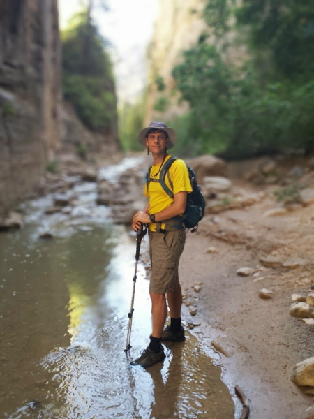
Tom and I were lucky enough to be awarded a permit for the top down hike of The Narrows, but we planned to do it in just a single day. It makes for a long day, as you have to cover 16 miles straight through, and about 14 miles of that is in a river. But we felt up to it.
We booked spots on a van with one of the outfitters in Springdale, the town located just outside the main entrance of the Park. We had to be at the outfitters store at around 6:00 and the ride to the trail head took about an hour and a half. We were dropped off around 7:30 or 8:00, and got started on the hike around 8:15 or so.
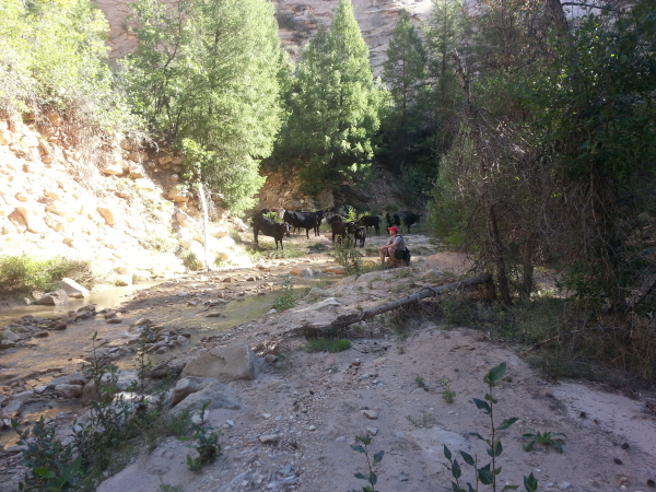
For the first couple of miles, you’re basically hiking by a small stream on a farm. We encountered quite a few cows during this part of the hike, and it’s probably why you’re discouraged from filling water bottles until you reach the junction of the Virgin and Deep Creek as the water is mixed with farm/ranch run off.

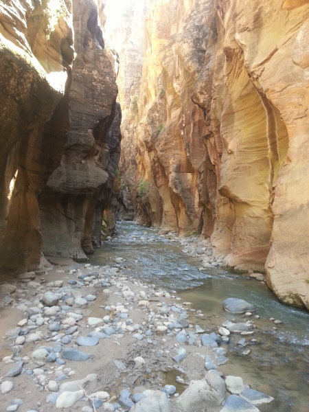
But slowly, the river widens and the canyon walls begin to get taller. Eventually, it becomes impossible to stay out of the river, and in you go. And then you get the canyons. And the canyons make this hike utterly amazing:

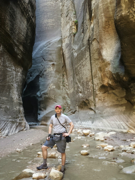
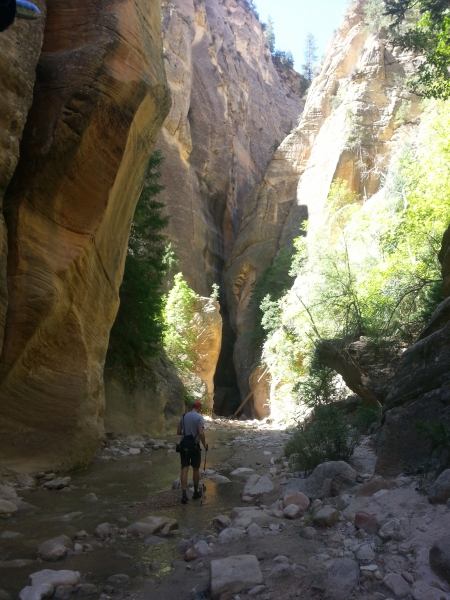

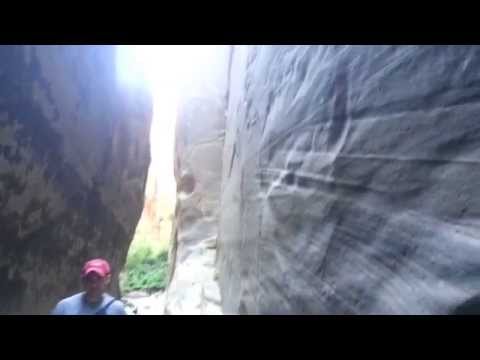
The best part, IMO, about doing The Narrows top down is that there are, on any given day, maybe 20 or 30 people hiking down the top section of The Narrows with you. Tom and I ran into maybe 10 people while we were hiking the top part of The Narrows. The rest of the time, it was a serene experience – just the two of us in an amazing canyon, taking in nature’s splendor.
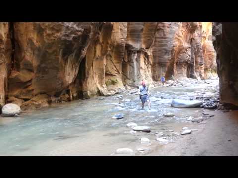
After about 6 miles of hiking, you reach the junction between Deep Creek and the Virgin River. The water level changes noticeably at this point. Prior to here, the water had never come up above maybe our ankles. However, from here on, water could easily come up to your knees, thighs, and at times your waist.
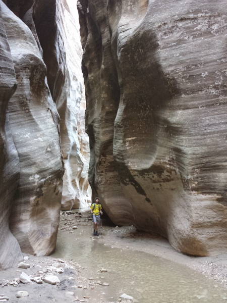
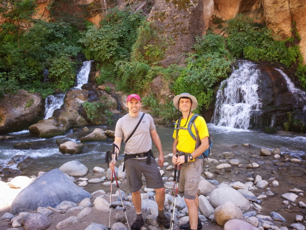
From the junction you head down the Virgin River and slowly pass the 12 campsites that are on both sides of the river, raised up fairly high to avoid flash floods. We stopped in one for lunch, then continued on down the canyon.
At about the 10 mile mark in the hike is where you hit Big Springs. Big Springs is about 6 miles in from the bottom of The Narrows and those hiking from the bottom up aren’t supposed to go beyond that point (we met one couple who had, but they quickly turned around when we pointed out that they were near the last campsite and had hiked too far). It’s at this point that the number of people around begins to climb pretty quickly. Of course, not many people hiking from the bottom up actually make it this far. It’s six miles through a river on very uneven terrain (making for a 12 mile hike). The outfitters who gear people up with canyoneering boots and equipment must realize just how few are actually going to go far up The Narrows. My guess is that less than half of those who start The Narrows make it more than 3 miles up the river before they turn around. It’s probably only 10% to 20% who make it all the way up to Big Springs.
Anyway, from Big Springs down to the bottom, the number of people slowly increased until, at the bottom, there was a veritable flood of people. The last 2 miles of the hike or so were kind of ruined by the swarm of people. Even so, we got 14 miles of amazing hiking. We exited the river around 4:00 or 4:30. We managed to do it all in about 8 hours or so, averaging about 2 miles per hour.
If/When I do The Narrows again, I’ll try to get an overnight permit. That way, I could take my time on the upper part and really enjoy it. Then, I’d get up early the next morning and try to get out of the river before the hordes of ill-prepared tourists flood the water. (Honestly, I saw people who had no business trying to hike up The Narrows giving it a shot: pregnant women carrying toddlers in their arms; people in flip-flops; very elderly individuals who looked quite frail. More power to them for trying, but they weren’t going to get very far.)
If you ever get a chance to hike The Narrows, try to do it the right way, from the top down. If you think about it, it’s only 4 miles more than hiking from the bottom up, but for 10 of those miles, you’ll be alone to enjoy the beauty of The Narrows. It is well worth it.

![]()
