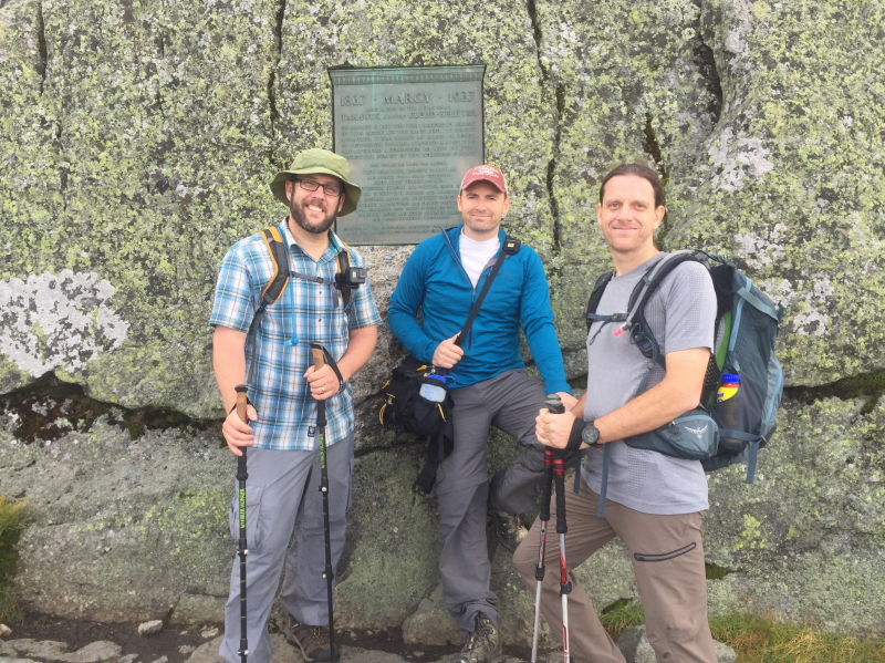
Summit Date
August 12, 2017 (around 11:00 am)
Party
Ryan Cragun, Mark Woolley, Tom Triplett
Trip Report
In my big swing across the US that allowed me to complete most of the highpoints in the Northeast in 2013, I didn’t manage to fit in Mount Marcy. It’s a solid day hike, and I just didn’t have the time. I ended up arranging a trip to Lake Placid, NY specifically to hike Mount Marcy, with my two hiking buddies.
We all flew into Newark on Friday, August 11th, picked up a rental car, then headed to Lake Placid, stopping in Albany for dinner and food to take up on our hike the next day. We arrived kind of late (close to 11:00 pm) and planned an early start the next morning (on the mountain at 7:00) in order to hopefully avoid the impending rain storm that was forecast for the next day.
The trip reports we read about the hike varied quite a bit. Some suggested it was really challenging, with a lot of uphill and rugged terrain. Others suggested it wasn’t that challenging and was a pleasant hike. We also got variable times and distances for the hike. Some trip reports suggested it would take as short as 4 hours while others suggested as many as 15 (that’s a pretty big range). Mileage estimates were also varied, though with a smaller range, hovering between 12 and 17 miles. Because of all the varied estimates, we planned for a 10 to 12 hour, 17-mile hike, just to be safe. As it turns out, using my GPS enabled watch, I now have much more accurate information on the hike.
We stayed at a B&B in Lake Placid, got up at 6:00 am, and drove straight to the Adirondack Loj. There is a parking fee there ($5.00), and by the time we arrived just before 7:00 am, the lot was getting pretty full. This is obviously a popular destination for hikers. We got our boots and gear on, did some stretching (a requirement once you hit 40), signed the register, and hit the trail.
We made good time for the first three miles or so, covering them in about an hour. The first three miles of the trail are fairly level and it is mostly a well-maintained dirt trail, with a few roots, rocks, and other small objects in the way. But around the 3-mile mark, there was a noticeable shift in the trail and terrain. Not only was there substantially more uphill terrain, but it became rocky to the point that at times you are literally boulder hopping.
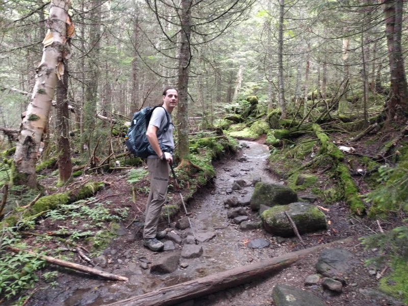
I’ve climbed a lot of mountains and was impressed with how rugged this trail got. This is not a trail you’d want to attempt in light tennis shoes (unless you’re an experienced trail runner); sturdy boots are a very good idea for this hike, ideally with good ankle support. We didn’t make as good of time on the remaining 4 miles to the summit but still did fairly well.
We arrived at the summit at just under 4 hours. When we arrived, the summit was completely enshrouded with clouds. We had no view whatsoever. We spent about 40 minutes on the summit, eating a little food and chatting with the forest ranger on the top who was reminding people to avoid the vegetation, which they are trying to get to grow back.
Alas, about 20 minutes after we dropped off the summit, the clouds broke and we finally had some nice views. It was at this point I took a photosphere:

We got better photos at this point, but we were still worried about the impending rain storm. The top of the mountain is largely exposed rock that wouldn’t be all that fun to ascend or descend in the rain. As a result, we opted not to return to the summit and instead to continue our descent. We stopped a few times on the way down to take advantage of some of the toilets that are along the trail and took a quick detour to the waterfall that is also fairly close to the trail. With our detours and stops, we returned to the parking lot in just under 8 hours. The distance on my watch indicated exactly 15 miles. So, there you have it – it is a 15-mile hike. Our average moving pace was 26 minutes per mile. If you know how quickly you can move on fairly rugged terrain, you should be able to estimate how long the hike will take you. We were passed by a couple who were clearly trail runners. They were the only ones moving more quickly than we were and they probably did the entire hike in 6 1/2 hours. I can see how this hike would easily take 12 hours if you’re not an avid hiker and in good shape. It is genuinely rugged terrain, particularly after the 3-mile mark, and you should be prepared for it.
Obviously, if you can, try to go on a nice day. The views from the top are supposed to be quite nice. But even hiking in cloudy conditions, the terrain was pretty. We passed through multiple types of forest – pine and maple – and really enjoyed ourselves.
Panorama

Directions

![]()
