

Summit Date
August 3, 2019
Party
Ryan Cragun and Tom Triplett (with logistical support from Mark Woolley, who almost made it)
Trip Report
Eighteen years after completing my first state highpoint (Utah’s King’s Peak), Wyoming is likely my last state highpoint – #49. While not the highest state highpoint, Wyoming is the longest hike as state highpoints go and is in very rugged terrain. As a result, we had to put a fair amount of planning into this hike.
Pre-Hike
The three of us met on July 31st to do a final gear check after having communicated for months about the equipment we would need. We were generally well-prepared for the hike with the relevant technical gear (e.g., harnesses, rope, helmets, ice axes, crampons, gaiters, crevasse rescue equipment, etc.). Tom had not picked up a few food items, but we were otherwise ready.
We also had a plan for the hike. Based on various trip reports, it looked like the “easiest” route (no route for Gannett Peak is easy) was the Glacier Trail from the east, entering through the Shoshone National Forest. Those trip reports also suggested that the hike was about 25 miles one way; 50 miles round trip. Thus, we had planned to hike about 10 miles per day, give or take a mile or two, to make for 5 good days of hiking.
Day 1 – August 1st
After a little debate about what time we were going to leave from Northern Utah for the trailhead, we eventually headed out around 5:30 am. The trailhead is just outside of Dubois, WY, which was about 5 hours away (see map below).
We stopped at the Wal-Mart in Evanston to pick up a few supplies along the way. We also had to make an emergency gas stop in Farson. We thought we’d have enough gas to make it to Lander but it seemed unlikely. Luckily, a gas station had just opened in Farson, otherwise, we probably would have run out of gas about 10 miles outside of Lander, which would have been a rough start to the hike.
We arrived in Lander around 10:30 where we topped off the gas. Mark picked up a fishing license. Tom stopped by an outfitter to pick up some crampons (the ones he had ordered hadn’t arrived). We then grabbed some lunch before heading to the trailhead, which was about an hour and a half outside of Lander. The turn off is about 4 miles outside of Dubois, WY and then roughly 9 miles on unpaved but well-groomed trails.
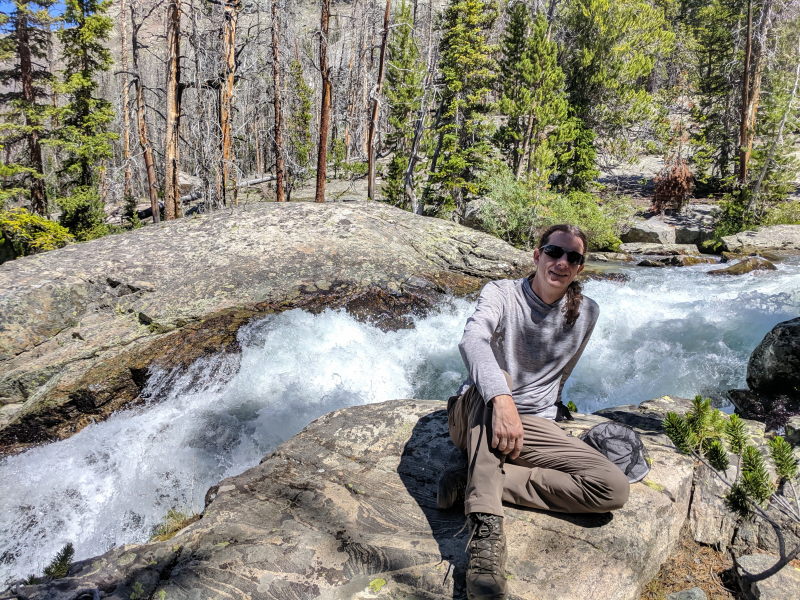
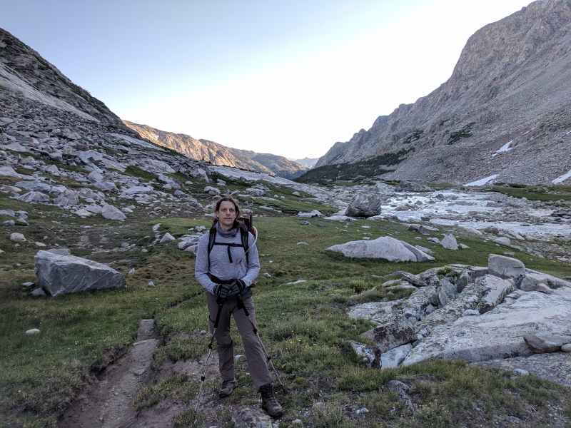
There were about a dozen cars at the Glacier Trail trailhead when we arrived. The weather looked great while we finished getting our packs ready. A family from France showed up just as we were getting ready to leave. They kindly snapped a photo of us before we hit the trail:

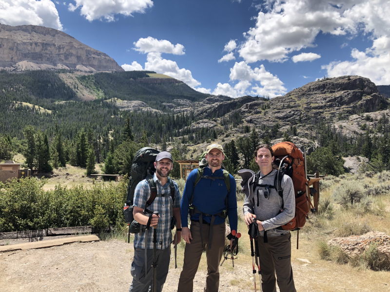
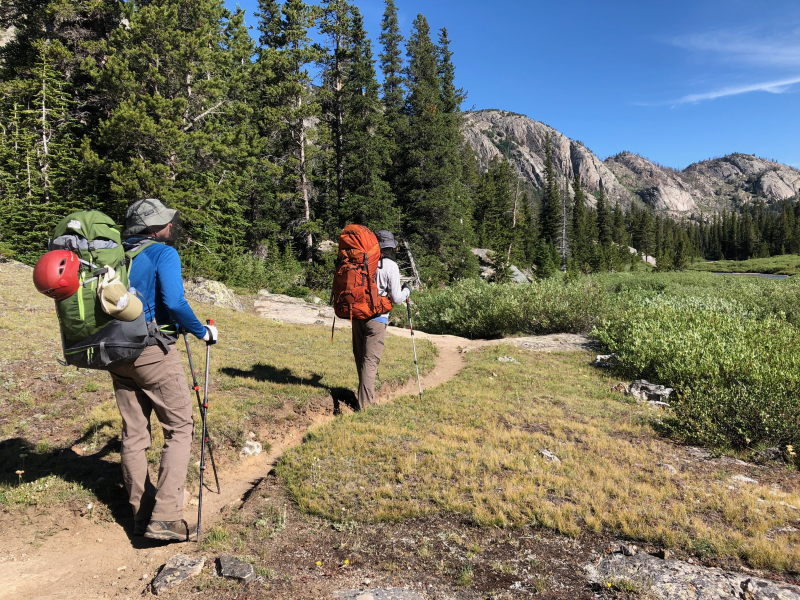
Per my Garmin watch, the starting elevation was 7,598 feet. We left the trailhead around 12:50. The trail starts by working its way up and over a ridge, crosses a river, then continues along some fairly rocky terrain for about 2 miles. Miles 3 and 4 are in Bomber Basin, which is pretty level and has several wide, beautiful meadows. We got caught in a brief rainstorm here that forced Tom and me to pull out our raingear for about 30 minutes. Miles 5 and 6 are some pretty serious switchbacks that increase the elevation quickly. At the top of the switchbacks, things level out for a little bit and you actually have a little downhill to a stream crossing where we stopped to pump/purify some water. After crossing the stream, it’s a slow steady uphill across a meadow and plateau that just keeps going and going. It’s a solid couple of miles on that plateau (at least 1 1/2 until you reach Arrow Pass). You cross a pass that my watch said was at 10,850 feet and is above the treeline. After that, you start a slow descent back into another valley.
Mark goes to the Wind Rivers (the mountain range that Gannett Peak is part of) every year with family, so he had warned us about the bugs. They weren’t horrible, but they were bad enough in the lower valleys that Tom and I had already put on our bug head nets and gloves to keep them off us. We were also wearing long pants and long shirts. Above the treeline, the bugs were not as bad. That fact gave us an idea – why not camp right at the treeline on the other side of Arrow Pass to minimize the bugs? We could see from the pass that the trail dropped down into the trees just before dropping steeply in elevation. We could see some spots that looked like they would work.
Just before we got to the pass, we also ran into two other hikers – Jason and Joe – who were busy flying a drone. Jason was carrying a 75 to 80-pound pack with tons of camera gear. We stopped to talk to them for a bit then continued toward our desired campsite.
Sure enough, as we approached the treeline, the bugs started back up. We worked our way to the left of the trail and eventually found a spot that was nestled at the top of the treeline and was nice and flat to set up camp. We quickly set up the tent, got a fire going, and cooked dinner, which was dehydrated meals in bags. Mark also informed us that he wasn’t feeling very well. He had a dry mouth and felt like he was going to throw up. That wasn’t a good sign.
After dinner, Tom prepared his bear cannister while Mark and I set up our bear hangs before turning in for the night. A light rain started just as we were climbing into the tent.
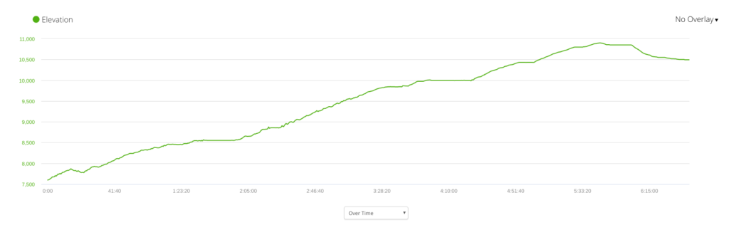
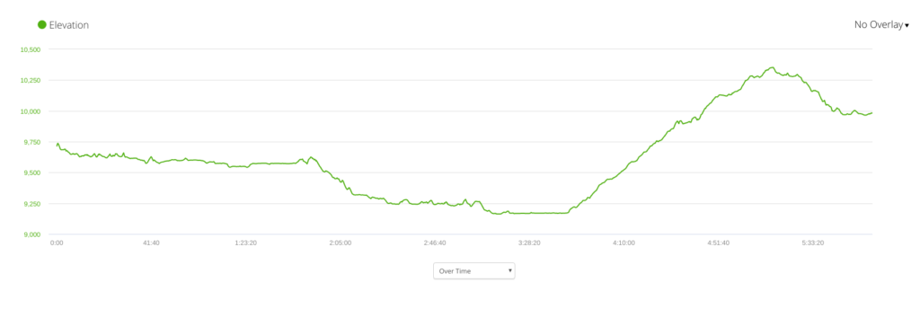
Per my watch, we started at 12:49 and did 10.22 miles over 6 hours and 40 minutes. Here’s a chart of the elevation gain:


Day 2 – August 2nd
Thinking we only had to cover 10 miles on day 2, we didn’t rush to get ready in the morning. We got up around 7:00 to 7:30, made breakfast, and slowly broke camp. We didn’t head out until 8:54.
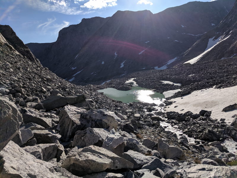
From where we camped, the trail drops pretty steeply into a valley filled with mountain lakes. Mile 2 put us at Double Lake. Star Lake was at mile 3. Just after mile 4 we could see Honeymoon Lake, which you can see from the trail, but the trail doesn’t get very close to it. Just after you see Honeymoon Lake, there is a series of switchbacks going down. This drops a lot of elevation quickly.
At the bottom of the switchbacks, we were running short on water (we hadn’t pumped since the day before). We found a small stream and decided to pump there and then have lunch. It was around mile 5 for the day and wasn’t a great spot. The mosquitos were really bad. Had we continued for another mile, we would have hit a great spot on the side of Dinwoody Creek (marked on the map below) that has beautiful views of the river and nice places to sit, plus fewer mosquitos and plenty of places to filter water.

After lunch, we continued on, eventually crossing a river at Down’s Fork.

The trail was pretty flooded at this point, which meant some creativity in trying to avoid the water, but it was generally doable. From then on, the trail largely follows Dinwoody Creek, which is a beautiful, glacial river.
Just before mile 10, we found a spot where the creek widens and flattens out. It was late in the afternoon at this point and we were hot. Right at that spot (marked on the map on day 4 below), there is a nice, sandy beach on the side of the river. When Tom saw it, he immediately decided he was getting in. He stripped down and walked through the river. The side closest to the trail is only ankle deep, but on the far side it gets deep enough to dunk yourself under (maybe 3 1/2 feet). It’s freezing cold, but a good break on a hot day. (NOTE: There is a trail here that stays close to the river. Don’t follow it. Stay close to the mountain. The one that stays close to the river eventually goes into the river. The actual trail skirts the side of the canyon and avoids all the marshes.)
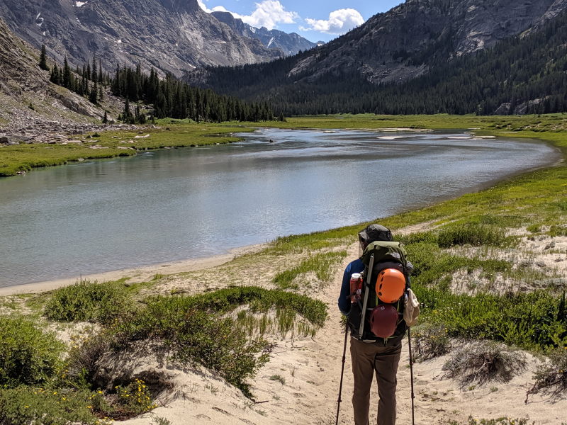
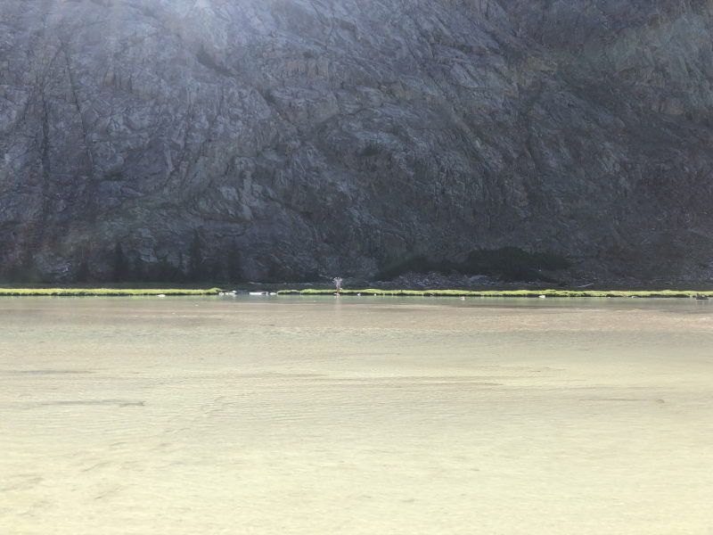
When we hit the 10-mile mark, we began to wonder how good the descriptions of the trail really were. We should have been about 5 miles from the summit of Gannett Peak at that point (we had gone 20 miles), but we couldn’t see the peak or the boulder field where we were supposed to spend the night. We had marked key indicators on our maps and Mark was using All Trails on his phone and could see that we still had miles to go. Given how Mark was feeling (and I was getting tired), we were getting a little worried. At 11 1/2 miles, we saw a camp across the river. We paused there and Tom went to see what it was. It’s an outfitter camp called “Camp Cowboy.” They take people up the mountain on horses. We found out from them that they had clients who had summitted that day. They camped at the boulder field, got up at 5:00 am, and made the summit by 10:00 am. But they didn’t tell us how far the boulder field was.
With the weight of the packs bearing down on us, we continued on. We crossed mile 12, then mile 13. By that point, it was close to 5:30 and both Mark and I were getting tired. Tom was willing to keep going, but it didn’t seem likely that we were going to make it to the boulder field that day.
As luck would have it, around mile 13, we took a bit of a wrong turn that walked us right through a beautiful campground. It was on a rise that had great views of the canyon. On the top was a ring of pine trees in a circle about 30 feet in diameter with a very nice, level spot for a tent. We eventually decided to make camp there for the night and came up with a plan for the next day.
Given how Mark was feeling (still quite sick), he had decided he was not going to try for the summit. Tom and I would leave most of our gear at the campsite with Mark and take just our technical gear, food, and water, and try to summit as fast as we could, returning to the camp hopefully in time to break camp and do a few miles back out on day 3. We couldn’t tell for sure at that point, but we thought the base of Gannett was only a couple miles away, which would go quickly with light packs.
So, we set up camp quickly. While Mark cooked dinner, Tom and I emptied our packs and repacked them for our summit attempt. We enjoyed a nice dinner, got everything situated, then hit the sack.
We covered 13.67 miles in about 9 hours. Below is the elevation chart for the day and the map:
Day 3 – August 3rd
The plan for our summit attempt was to get up early (5:00 am), head out by around 5:30, and move quickly. Thinking we only had a couple of miles to get to the base of the mountain, we figured we could be on our way up by 7:00 or 8:00 at the latest. We figured we could make it to the top in 2 to 3 hours, then get back off the mountain and ideally be back to our camp by early afternoon, late afternoon at the latest. We laid all of this out to Mark, who had our Garmin satellite communicator. He could start worrying if we weren’t back by 6:00 pm. We didn’t think it would take us that long to get back to our camp.
We were wrong.
We got up at 5:00 and headed out at 5:36. We made good time. We did our first mile in 26 minutes (just 229 feet of elevation gain), the second was just 24 minutes (150 feet of elevation gain). But we still were not to the boulder field. The third mile took us another 26 minutes (341 feet of elevation gain). At that point, we had crossed a couple of rivers and were climbing.

The fourth mile was 30 minutes with 417 feet of elevation gain. By the end of the fourth mile, we could finally see the boulder field.
We were way off in our estimate. The base of the mountain was about 5 miles from where we camped.
Hopping across the boulder field took us close to 40 minutes. We paused to figure out a route up the mountain as well. Luckily, we spotted four climbers on the mountain working their way up a chute, which showed us where we needed to go. But we had no idea how they got there. We studied the mountain for a while and figured out a route that seemed to align with trails we could see, but it was definitely not the standard route up the mountain.
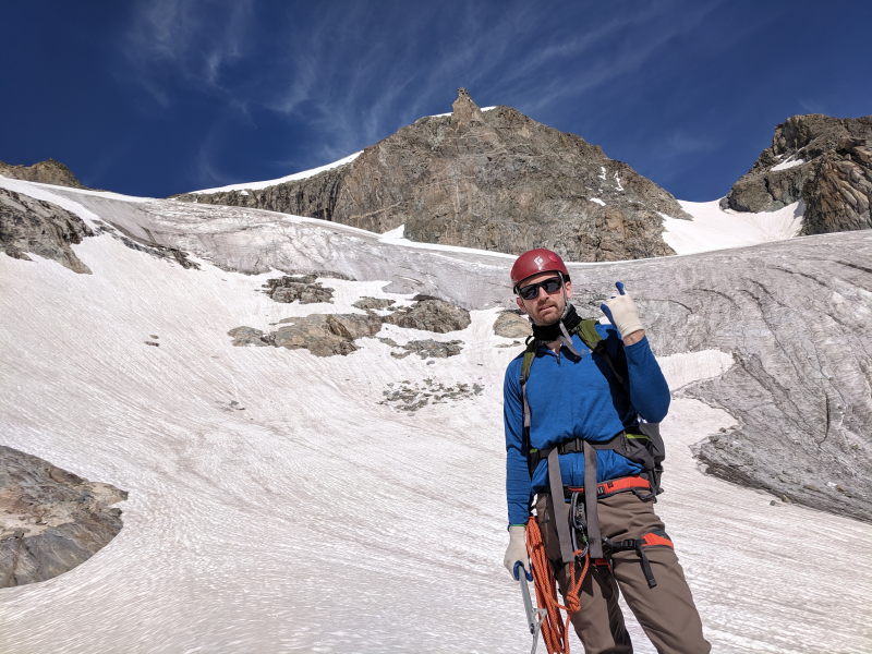
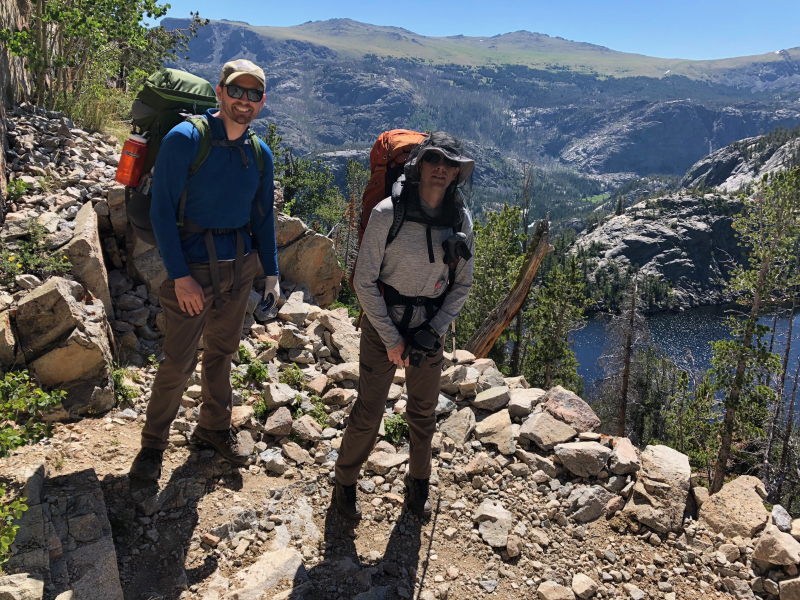
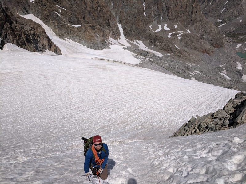
Below is a photo of the summit from the top of the boulder field. I drew in two routes. In green is what we think is the standard route up the mountain. It heads to the left, cuts around a jut of rock, then works its way up to a ridge before getting on the glacier and working its way up the chute and over the bergschrund (snow bridge), then following the ridge to the summit. In red is our route. We cut up the face, crossed a snow patch, then ended up on the glacier. We roped up and put on our technical gear and did a switchback up the glacier. Just as we were finishing our switchback, two guys came up the ridge on the standard route and passed us. It’s much faster to climb the rocks on the ridge.

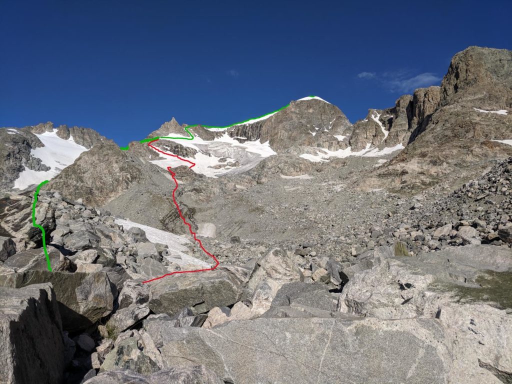
Where the red and green lines meet, it’s time to get on the snow. You cut below the sharp, jagged peak there and then work your way up the first chute which is where the bergschrund is. Basically, there is a crevasse at the bottom of the chute that is often covered with a snow bridge. When we crossed it, the snow bridge was really soft and had almost melted all the way through. If it melts all the way through, getting over this spot would be quite challenging.
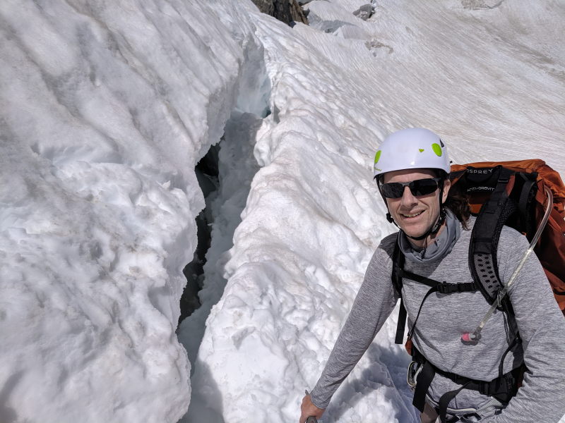
The chute is also quite steep, probably a 70 to 80-degree grade in spots. We short-roped our way up it. After we made it to the top of the chute, we followed a fairly clear trail that tracks to the top of the snow just below the ridgeline. You have to cross a couple of vertical ridges running down the mountain, but from the top of the chute, it’s pretty much a long, slow hike about another half mile to the summit, which you can’t actually see in the photo above (it’s hidden behind the snow-capped part of the mountain).
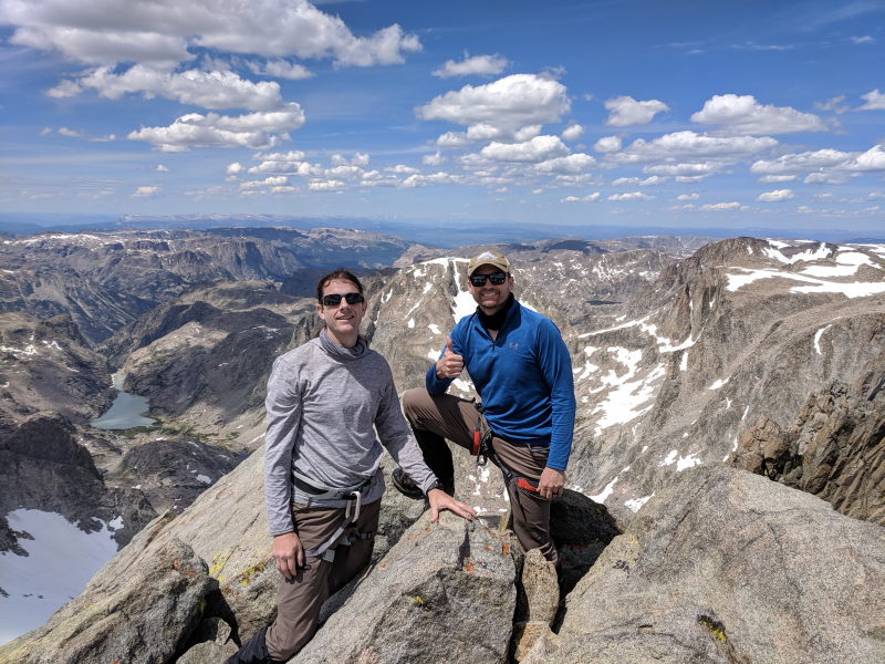
While we made good time before the boulder field, after the boulder field, our time slowed dramatically. The rough terrain and elevation really slowed us down (plus, we didn’t bring enough food – a few packs of gummies, some M&Ms, and a few granola bars). We finally arrived at the summit around 1:00 pm.
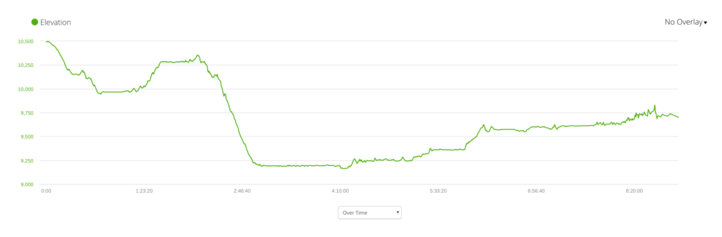
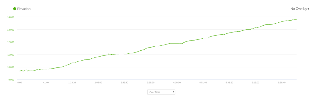
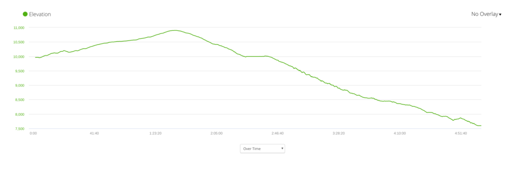
From our camp to the summit was 7.5 miles, 4,410 feet of elevation gain, and it took us 7 hours and 20 minutes. Here’s the elevation chart:


My obligatory panorama on the summit:
And Tom’s traditional handstand:

We chatted with some folks on the summit for a bit, ate a little food, and took a break for about 30 minutes. We snapped photos and I even got a signal on my phone, so I texted Mark that we’d be late and texted my wife that we had made it.
Then we headed back down. My watch was almost dead and I didn’t have anything to charge it, so I didn’t track our time back down, but we did pretty well considering how technical it was.
We did take advantage of the fact that we had been on the glacier already and slid down a few spots:


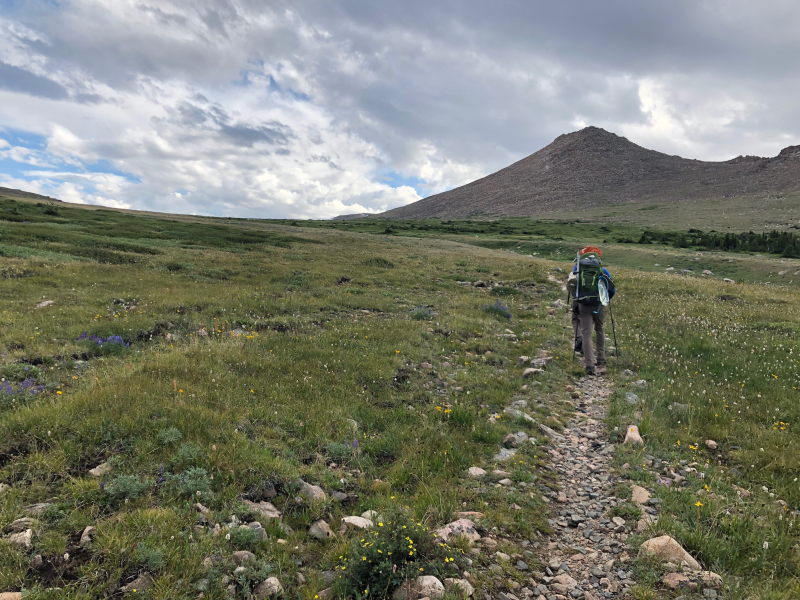
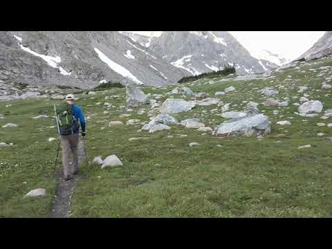
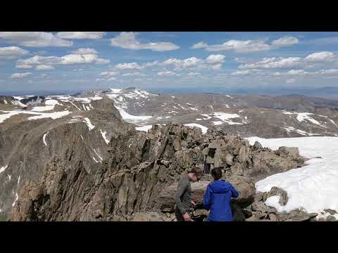
That helped. But I was moving pretty slow on the boulder field on the way out. My reconstructed knee (ACL) was hurting and I didn’t want to aggravate it. We made it to the end of the boulders around 5:00 and had 5 miles to go to get back to our camp. It didn’t help that the upper valley is so beautiful that I stopped a few times to take pictures and videos:

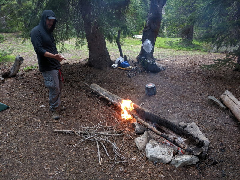
We made pretty good time, but still missed our 6:00 pm deadline for when Mark could start worrying. We got back to our camp around 7:20. Mark had a fire going and quickly cooked us dinner as we described the adventure.
Meanwhile, Mark had a nice, relaxing day exploring the area. By the end of it, he was feeling much better:

Day 3 total distance traveled was 15 miles – 7.5 to the summit and 7.5 back to our base camp.
Day 4 – August 4th
Having a better sense of the route, we knew about how much hiking we had to do the last two days. We figured we didn’t have to get up super early and had to do about 11 miles on day 4 to get to Double Lake, where we wanted to camp. We ended up getting up around 6:30 and broke camp around 9:00 am.
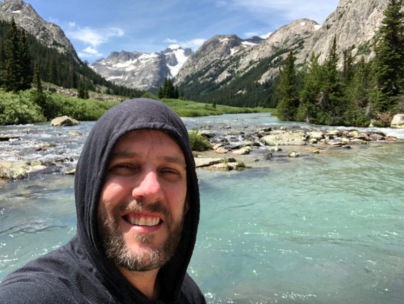
The upper canyon is definitely the most beautiful part of the hike:
A couple of miles down the trail from our camp we returned to that beautiful spot in the river and took a bath – our first in nearly 4 days.
We made pretty good time on the way down, stopping just a couple of times to pump water. We even made good time up the switchbacks by Honeymoon Lake. We made it to Double Lake by about 3:30, which was the goal.
Mark brought fishing gear and wanted to try his luck fishing. By 4:00, Tom had taken refuge in the tent (the bugs were really getting to him at this point).

Mark and I went out to see if the fish were biting. I actually followed Mark out without him knowing. I figured it would be a nice view while I read a little on my phone and shot some photos of Mark fishing.
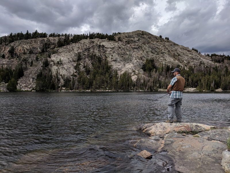
But that all changed on Mark’s second cast. I heard him grunt on the second cast and asked him if he’d caught something. That’s when he told me he caught a fish on his first one but had already let it go. He caught a fish on his second cast, and third, and fourth. Basically, the first 20 times he cast his line, he caught a fish about 16 of those.
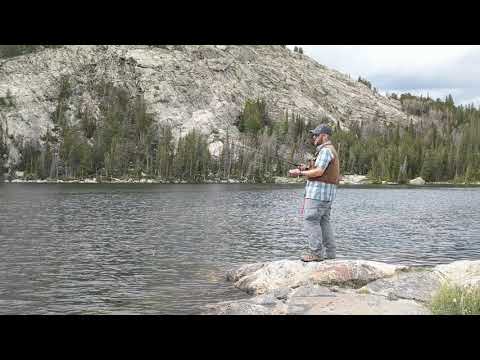
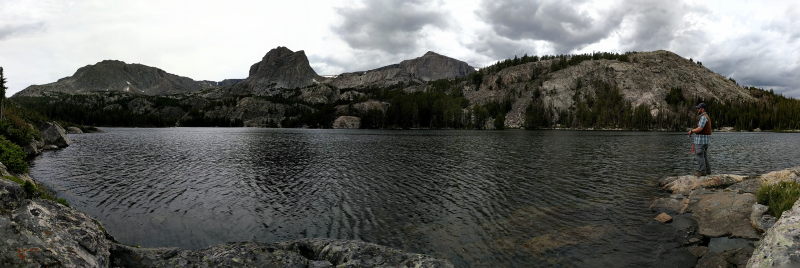
Then, for the next two hours, it was about every third cast we caught a fish. Mark got tired of casting and asked me to cast. I was enjoying the view:

But I eventually agreed and ended up catching two of the three fish we kept and ate for dinner.
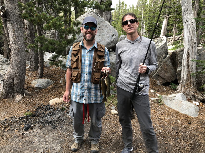
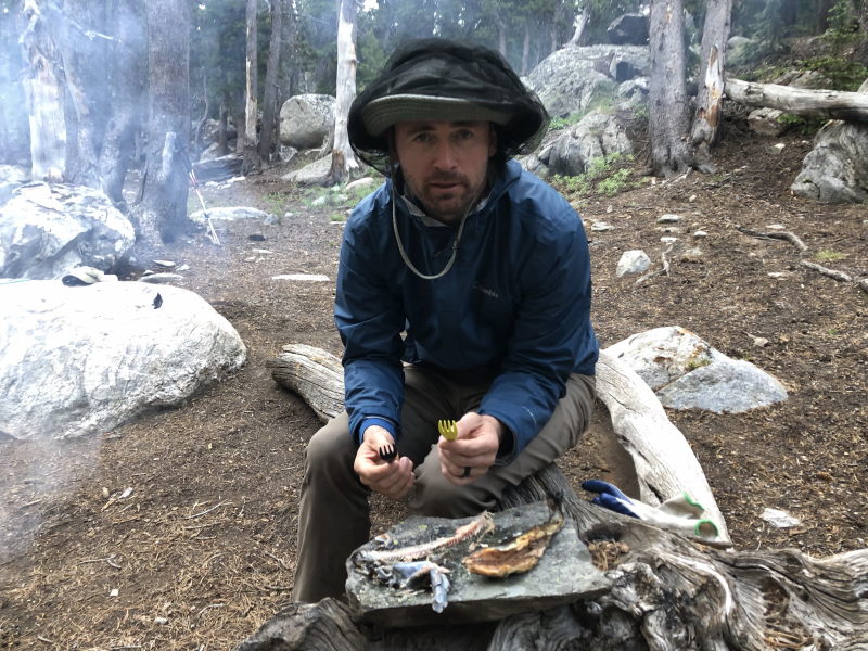
While we were excited to have something other than dehydrated food for dinner, we didn’t fully think this through. We had a way to cook the fish (on a flat rock on the coals of our fire), but we didn’t have a plate. Enter flat rock number two. Also, Mark broke out his fish seasoning, which he hadn’t told us he brought with him. The mountain trout was amazing!
Just as we were finishing up dinner, the temperature dropped a good 20 degrees and we realized a storm was blowing in. We quickly cleaned up our camp, doused the fire, set up our bear hang with the remaining food, and got into the tent. Sure enough, a good storm blew in. The rain wasn’t too heavy, but the heaviest on the whole trip and the wind was pretty strong. My super light, 3 man tent held up well. It was only about 7:30 when we got in the tent, so we ended up playing Risk on Mark’s phone for about an hour (Tom won) before going to bed.
Total mileage for the day: 10.38 miles in 6 hours. Here’s the elevation chart:

Day 5 – August 5th
We also didn’t plan to rush to break camp this day knowing that we had to do about 11 miles or so to get to the trailhead with most of it being down hill. But none of us were sleeping that well on the mountain, so we ended up waking up around 6:00 am (Mark and I are usually up before that at home as well). We broke camp at 7:30 and made pretty good time. It took us just 5 hours to cover the 11.26 miles from Double Lake to the trailhead. Here’s the elevation chart:

We were off the mountain around 1:30. We drove straight to Lander and stopped at Gannett Grill for lunch. Here’s our route on Day 5:
Concluding Thoughts:
First and foremost, people need to realize that this route to Gannett Peak isn’t 50 miles round trip. If you add up all the miles, it was 31.39 miles from the trailhead to the summit (that probably includes about 1 extra mile of me pumping water and such while my watch was tracking distance). The distance on the way out is probably a more accurate approximation of the exact distance since we didn’t stop as much: 29.14 miles. In other words, the eastern approach to Gannett Peak via the Glacier Trail is really 60 miles round trip, not 50 miles. To do this in 5 days, comfortably, you should plan to hike at least 11 to 12 miles the first day (to Double Lake) and the same distance the second day (to the boulder field). The boulder field is a nasty place to camp. Unless your into rock falls and no vegetation, it’s not particularly beautiful, though it is surrounded by imposing mountains. I’d suggest camping at the boulder field on the second night, summiting the morning of the third day, then hiking down about 5 miles to our campsite to enjoy the views there. Then the hike out is about 11 miles each of the last two days.
If you’re into fishing, definitely take your fishing gear. Double Lake was incredible. Most of the fish were really small (maybe 8 inches), but we managed to catch two 12 inch fish and a 10-inch fish that we enjoyed for dinner. It still wasn’t a meal, but two fish probably would have been for me.
I hope my description of the route up the summit is helpful. We screwed that up and it would have probably saved us 30 to 45 minutes or more and probably cut some distance off our ascent.
Obviously, the lighter you can pack, the better. I was carrying a 55-pound pack for all but the summit day. That’s too much for me. If you can get your pack to 40 pounds, you’ll be much happier. We ended up hiking out food, but we probably should have eaten it.
That leads to my next point. I was running a calorie deficit the whole hike. While I snacked and ate three times a day, I was burning a lot more calories than I was consuming. I started the hike weighing about 165 (usually closer to 164). I ended the hike at 155. I lost almost 10 pounds. I didn’t have much of an appetite, but I should have eaten more.
Finally, visiting all of these states to hike state highpoints has been quite the adventure. I’ve spent weeks of my life on this and thousands of dollars. But it has been worth it. I have amazing memories and crazy stories. I’ve secured friendships and made new friends. It’s been a remarkable journey.
![]()
