Category: travel
-
Prague Day 1 – walking tour
Debi’s work brought us to Prague for about nine days. She was busy for 6 of those days, leaving me to wander around on my own during much of the time. In this and subsequent posts, I’ll detail our/my adventures in Prague. We arrived on a Saturday (5/13). Our flight landed at 10:00 am and…
-
Norway Trip – Part 2 (of 2) – Stranda
Day 9 Sunday, June 5th, we drove from Bergen to our second AirBnB, which was located near the Sunnmørsalpane Skiarena Fjellsætra (you can ski directly to the house where we stayed). The drive took somewhere around 6 to 7 hours. It was rainy and driving in a foreign country is a bit stressful, but manageable…
-
Driving in Norway – June 2022
We spent just over two weeks in west-central Norway in June 2022. We rented an Audio E-tron and drove all over the place. Here are a few things I noticed while driving in Norway. Driver’s License Some European countries require an international license. From what I can tell, international licenses are basically a scam to…
-
Norway Trip – Part 1 (of 2) – Bergen
My wife, Debi, had an opportunity to contribute to a workshop run by a professor at the University of Bergen. Her involvement helped pay for her travel and lodging for a week, so we decided to make a trip to Norway our family vacation for the year. We booked a week in Bergen and a…
-
Credit Cards, Two Factor Authentication, and International Travel
We recently traveled to Norway for a combination of work and vacation. As a tech enthusiast, I’m all about ways to make life easier and tech can often accomplish that. But, there are some downsides, like the one I’m about to describe. I have three credit cards that don’t charge foreign transaction fees, one of…
-
Cell Service and SIMs in Norway – May 2022
What follows is a detailed description of our experience getting pre-paid SIMs for our cell phones in Norway. I had looked up the major carriers in Norway thinking they would all offer prepaid SIMs. From what I could find online, I decided to go with Telenor as it has good coverage and I knew we…
-
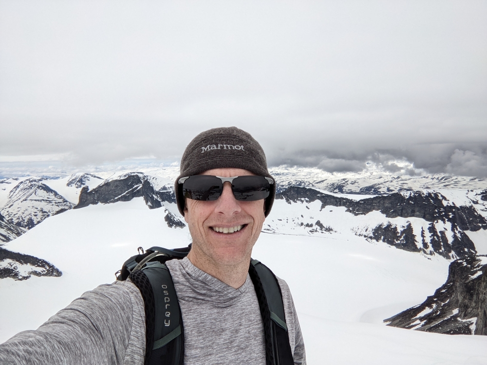
Norway – Galdhopiggen
I was in Norway on vacation with my wife and son (see here and here). We did a fair amount of hiking, and I originally thought we would all do this hike. But I caught a trip report a couple days before I did the hike that indicated it was still mostly covered in snow.…
-
Pickens, SC – Hiking Trip – Day 7 – movie marathon
It was supposed to rain on our last day of our trip to South Carolina. Our plan was to spend the day inside playing games and watching movies. It took us all day, but we managed to finish all of the extended versions of The Lord of the Rings trilogy, which is close to 12…
-
Pickens, SC – Hiking Trip – Day 6 – Table Rock
We saved our longest hike for last. Perhaps the most well-known and scenic hike in the area near our cabin is Table Rock Trail. This leads to the top of a mountain and then, just past the summit, to a beautiful overlook. Despite the trail being well-worn and marked with red blazes, we actually lost…